
CartoMANDU
Geomorphological Map of Mandu (Madhya-Pradesh, India) : Risks, Ressources, Resilience
Scientific responsibility :
- Anne Casile
- David Sarmiento-Castillo
- Eric Fouache
Methodological axes :
Thematic fields :
Disciplinary sectors :
Partnership :
Funding :
- DIM PAMIR
Project ID : IDF-DIM-PAMIR-2026-10-004
Summary :
The work will involve compiling an inventory of geographical studies already carried out as part of the Mandu project and producing a summary geomorphological map accompanied by a report. This report and map aim to identify the environmental constraints that have influenced the development of the site, the resources available for the development of the city and its surrounding area, as well as enabling the identification of sedimentary records in the thalwegs, thereby paving the way for a future palaeo-environmental study to reconstruct erosion patterns and the impact of development – particularly hydraulic works – on catchment dynamics. The aim is also to assess natural, climatic (particularly due to the seasonal monsoon) and geomorphological risks that could damage archaeological structures, as well as the consequences of agricultural intensification and urban pressure.
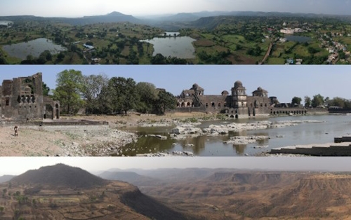
Legend: View of the Mandu plateau during the monsoon season (top) and the pre-monsoon season (bottom). In the centre, part of the Jahaz Mahal (Ship Palace) complex during the dry season
